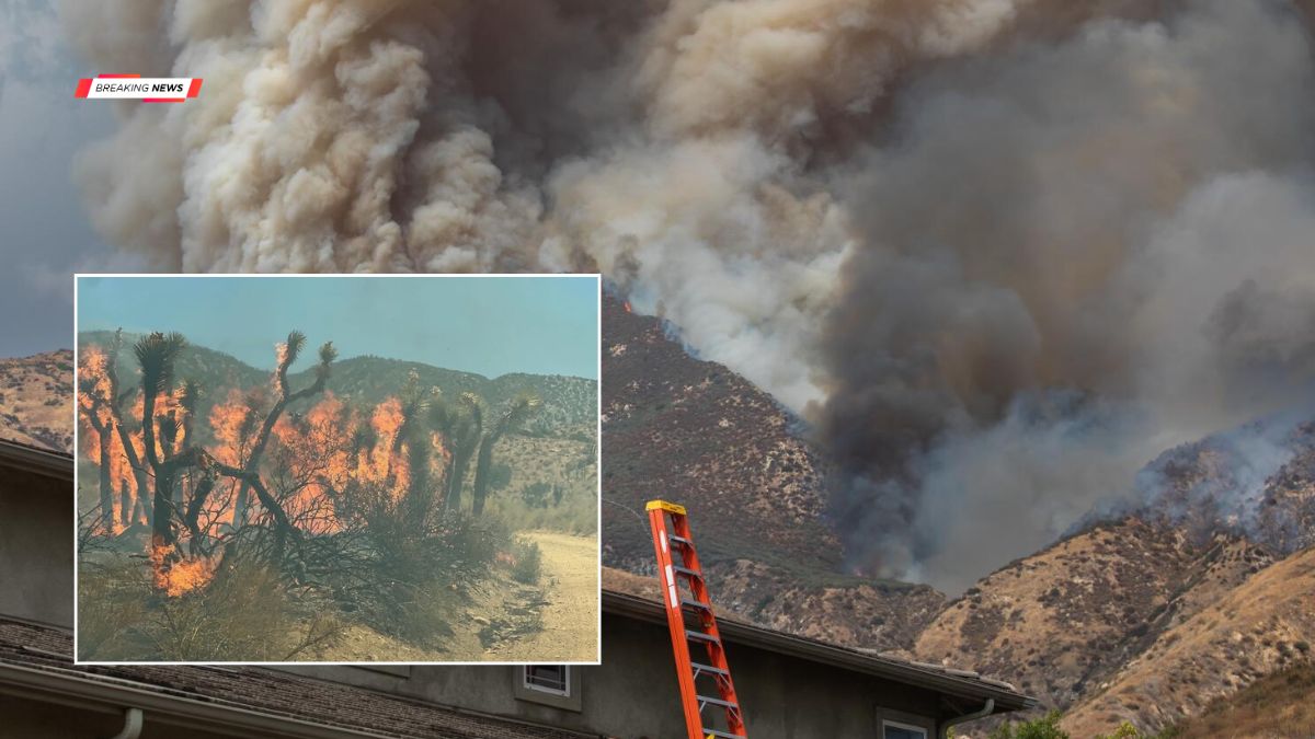
A fast-moving wildfire that started in Los Angeles County on Friday expanded rapidly and moved toward communities in San Bernardino County by the evening. The Summit Fire grew to more than 2,700 acres within hours, prompting evacuation warnings, smoke advisories, and concerns about air quality across parts of the High Desert.
The Summit Fire was reported shortly before 1 p.m. Friday in Los Angeles County, according to Cal Fire. Fueled by dry vegetation and fire-friendly conditions, the blaze expanded quickly and had burned 2,709 acres by 4 p.m.
Officials said the fire was 0% contained at that time and had crossed into the Angeles National Forest, with heavy smoke drifting northeast toward San Bernardino County.
Growth
The wildfire spread rapidly during the afternoon, highlighting the challenging conditions firefighters faced.
| Event | Details |
|---|---|
| Fire reported | Just before 1 p.m. Friday |
| Acreage by 4 p.m. | 2,709 acres |
| Containment | 0% |
| Fire location | Los Angeles County into Angeles National Forest |
Fire crews continued working to slow the fire’s advance while monitoring changing weather and terrain conditions.
Evacuations
As the fire approached San Bernardino County, officials issued evacuation warnings for several communities.
Shortly before 6 p.m., evacuation warnings were in effect for the areas identified as PIN005, PIN006, and WWD03.
County officials advised residents who may need additional time to evacuate, including those with pets or livestock, to leave as soon as possible. Updated evacuation maps are available through the San Bernardino County emergency website.
Air
Smoke from the Summit Fire affected air quality across parts of the Mojave Desert.
Just before 5 p.m., the Mojave Desert Air Quality Management District issued a smoke advisory, warning that smoke conditions could change throughout the day.
Residents in Apple Valley and Victorville reported smelling smoke, while officials encouraged people to monitor local air quality conditions through AirNow.gov.
Sensitive groups, including older adults, children, people with respiratory conditions, and those who spend extended periods outdoors, were advised to reduce outdoor activities if smoke levels increased.
Preparedness
Emergency officials encouraged residents in threatened areas to prepare an evacuation go-bag containing essential items, including:
| Recommended Items | Purpose |
|---|---|
| Medications and medical records | Health needs |
| Identification and important documents | Personal records |
| Phone charger and cash | Emergency communication |
| Water, snacks and first aid supplies | Basic necessities |
| Pet food and supplies | Animal care |
| Emergency contact list | Family communication |
Officials also recommended including any additional items required for individual or family needs.
Shelters
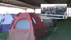
Evacuation shelters were opened for residents displaced by the wildfire.
The Antelope Valley Family YMCA at 43001 10th Street West in Lancaster is accepting evacuees, and small pets are permitted at the shelter.
Residents needing accommodation for small animals may also use the Los Angeles County Animal Care Center at 38550 Sierra Highway in Palmdale.
Response
Firefighters from multiple agencies continued working Friday evening to contain the Summit Fire as it threatened nearby communities and natural areas. Officials urged residents to stay informed through official emergency alerts and follow evacuation instructions if conditions changed.
The Summit Fire remains an active incident, with fire crews continuing suppression efforts while emergency managers monitor fire behavior, weather conditions, and public safety across Los Angeles and San Bernardino counties.
FAQs
How large is the Summit Fire?
The fire had grown to 2,709 acres Friday afternoon.
Which areas have evacuation warnings?
PIN005, PIN006, and WWD03 are under warnings.
Is the fire contained?

Officials reported 0% containment Friday afternoon.
Where is the evacuation shelter?
The Antelope Valley Family YMCA in Lancaster.
How can residents check air quality?
Visit AirNow.gov for local air quality updates.