
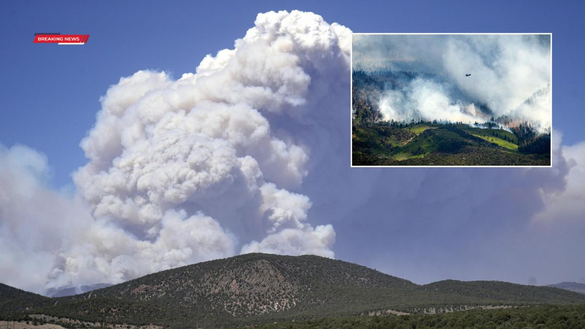
An extremely critical fire weather threat is expected to impact the Four Corners region as multiple large wildfires continue to burn across the western United States. Forecasters warn that hot, dry, and windy conditions could fuel rapid fire growth and create dangerous behavior in already active fire zones, while new ignitions remain a concern.
The heightened risk comes as several major fires continue to expand across Utah and surrounding states, with some still uncontained and spreading in difficult terrain.
Fire Activity
Wildfire activity remains significant across parts of the West, particularly in Utah, where multiple large fires are ongoing.
The Cottonwood Fire has burned more than 71,000 acres and remains 0% contained. The Iron Fire has grown to over 40,000 acres and is currently 38% contained. A merged incident, now referred to as the Cherry Fire following the combination of the Maple Peak Fire and the original Cherry Fire, has burned approximately 20,000 acres and also remains 0% contained.
Fire officials continue to monitor fire lines and weather conditions closely as crews work to prevent further spread.
Risk
A Level 3 of 3 fire weather threat is in place for portions of eastern Utah, western Colorado, northeast Arizona, and northwest New Mexico. This designation indicates extremely critical fire conditions.
Meteorologists say sustained winds of 25 to 35 mph, with gusts reaching up to 55 mph, combined with single-digit humidity levels, are creating an environment where fires can ignite easily and spread rapidly.
A summary of key fire weather factors is shown below:
| Factor | Forecast Condition |
|---|---|
| Wind speeds | 25–35 mph sustained |
| Wind gusts | Up to 55 mph |
| Relative humidity | Single digits |
| Vegetation status | Extremely dry fuel conditions |
Officials warn that these conditions can lead to erratic fire movement and rapid expansion of existing wildfire boundaries.
Conditions
The Four Corners region is particularly vulnerable due to extremely dry vegetation and ongoing drought conditions. Many areas in the western United States experienced historically low snowpack during the past winter, which has contributed to reduced soil moisture and increased fire risk heading into the warmer months.
Fire behavior experts note that when dry fuels combine with strong winds, fires can shift direction quickly and become difficult to contain even with aerial and ground support.
Broader Weather
While fire danger intensifies in the Southwest, other parts of the country are dealing with different severe weather impacts, including flooding and thunderstorms.
Flood watches remain in effect across portions of the central and eastern United States, including areas from Missouri and Arkansas through Ohio Valley and into West Virginia. Officials have warned of potential flash flooding in several states due to repeated rounds of heavy rainfall.
In Kentucky, Gov. Andy Beshear declared a state of emergency as widespread flooding continues, with heavy rainfall expected to persist into the night.
Severe Storms
Separate regions are also facing severe thunderstorm threats. Parts of North Carolina are under a Level 2 of 5 severe weather risk, with damaging winds expected.
A stronger Level 3 of 5 risk is in place across portions of the northern High Plains, including areas of North Dakota, Montana, and South Dakota. These storms could bring large hail, damaging winds, and isolated tornadoes.
Affected cities include Minot, North Dakota; Glendive, Montana; Bismarck, North Dakota; and Rapid City, South Dakota.
Heat
At the same time, extreme heat is building across the central United States and is expected to expand eastward through the coming week.
Forecasts indicate widespread 90-degree temperatures across the Midwest, with some locations potentially reaching the upper 90s. Heat index values could climb into triple-digit territory due to high humidity.
Major cities, including Chicago, Detroit, and areas along the I-95 corridor from Washington, D.C., to New York, are expected to experience prolonged heat conditions beginning midweek.
Meanwhile, cooler-than-average temperatures are expected to persist in parts of the western United States, including areas affected by wildfire activity.
Outlook
Fire weather conditions in the Four Corners are expected to remain elevated through the weekend, with officials closely monitoring wind patterns and humidity levels. Meanwhile, shifting weather systems across the country are producing a mix of hazards, from flooding and severe storms in the East to heat waves in the central and eastern regions.
Authorities continue to urge residents in fire-prone areas to stay alert, follow evacuation guidance if issued, and avoid activities that could spark new fires.
The Four Corners region faces a period of extremely critical fire danger as multiple wildfires continue to burn across the West. Combined with drought conditions and strong winds, the risk of rapid fire spread remains high. At the same time, other parts of the country are dealing with flooding, storms, and extreme heat, highlighting a broad and active severe weather pattern across the United States.
FAQs
Where is the highest fire risk?
The Four Corners region including Utah, Colorado, Arizona, and New Mexico is under extremely critical fire danger.
What is causing the high fire risk?
Strong winds, extremely dry air, and drought conditions are contributing to rapid fire spread risk.
How large are the current wildfires?

Some fires in Utah have burned tens of thousands of acres, with limited containment.
Are other weather threats happening?
Yes, there are also floods, severe storms, and an incoming heat wave across parts of the U.S.
Will conditions improve soon?
Fire danger may persist through the weekend, while heat and storm systems continue shifting across regions.