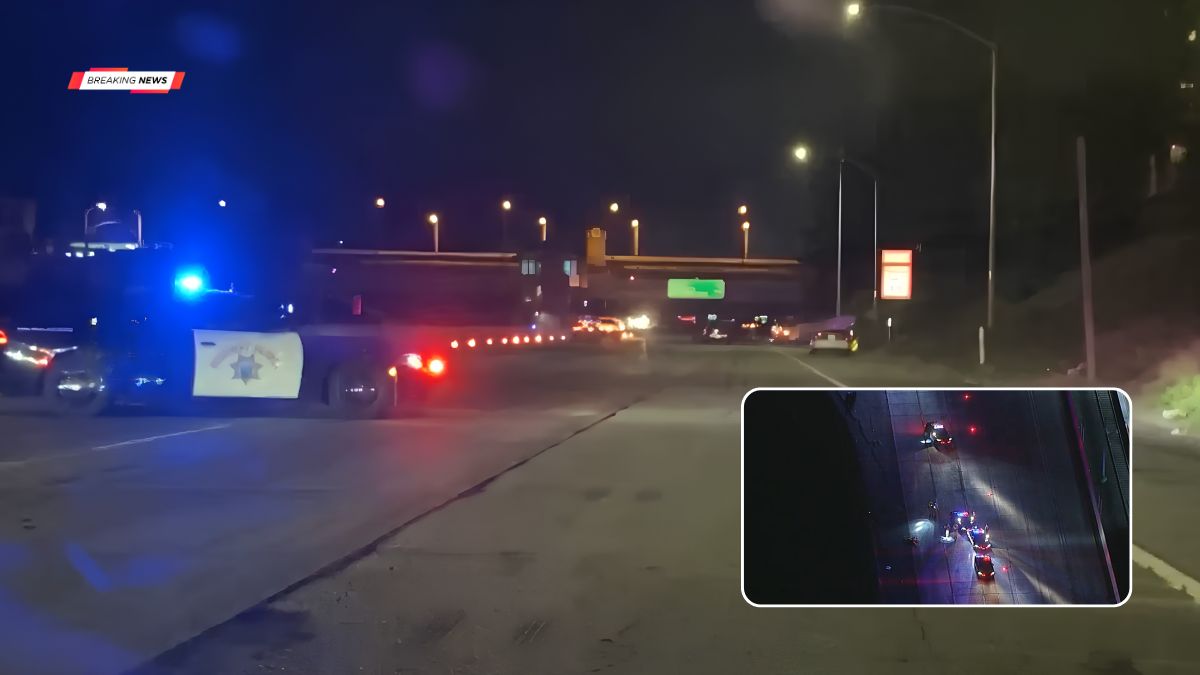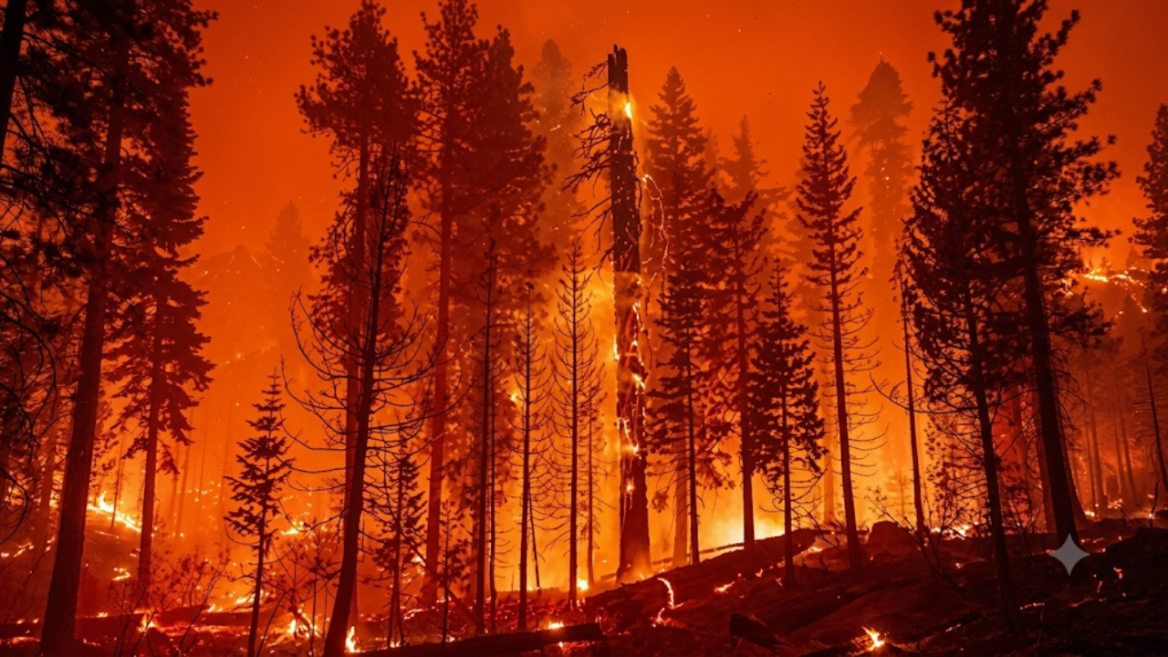
LOS ANGELES COUNTY, California — Firefighters have reached 63% containment on the Lemon Fire burning in northern Los Angeles County, bringing cautious optimism as crews continue to secure the perimeter of the blaze near Palmdale. The wildfire, which ignited in the foothills south of the Antelope Valley, has burned hundreds of acres and prompted evacuation warnings as officials worked to slow its spread.
The Lemon Fire was first reported near Sierra Highway and Pearblossom Highway, an area south of Palmdale known for dry brush and steep terrain that can accelerate fire behavior under windy conditions. While forward progress has been significantly slowed, officials stress that containment does not mean the fire is fully extinguished, and hotspots remain a concern for firefighters working in the field.
Emergency response teams from the Los Angeles County Fire Department continue to monitor flare-ups, strengthen control lines, and assess damaged areas as the situation stabilizes.
Fire Location and How the Lemon Fire Started
The Lemon Fire originated in Los Angeles County’s northern region, near the intersection of Sierra Highway and Pearblossom Highway, south of Palmdale. This area sits within the Antelope Valley foothills, a region frequently impacted by dry conditions, high temperatures, and seasonal winds that increase wildfire risk.
According to incident updates, the fire was first reported around early afternoon on June 13, 2026, and quickly spread through dry vegetation. The terrain surrounding the ignition point includes brush-heavy slopes and open desert edges, allowing flames to move rapidly before initial containment lines could be established.
Fire officials have not yet determined the official cause of the blaze, and investigations are ongoing. As is standard procedure, authorities are examining whether natural causes, equipment failure, or human activity may have contributed to the ignition.
Fire Growth and Response Efforts
In the initial hours after ignition, the Lemon Fire expanded quickly due to dry fuels and regional wind conditions. At its peak growth phase, the fire spread across more than 200–300 acres before firefighters were able to slow its forward movement.
Los Angeles County Fire Department crews, supported by ground units and aerial resources, worked to construct containment lines around the perimeter. Firefighters deployed engines, hand crews, and aircraft to drop water and fire retardant in key areas to prevent further expansion.
By the following updates, crews successfully halted the fire’s forward progress, allowing them to shift focus from active suppression to containment strengthening and mop-up operations. Mop-up work includes extinguishing hot spots, removing smoldering debris near control lines, and reinforcing boundaries to prevent rekindling.
Officials credited coordinated ground-air operations and improved mapping data for helping firefighters gain control over the blaze more quickly.
Evacuations, Containment, and Current Conditions
At the height of the incident, evacuation orders and warnings were issued for nearby zones, particularly those closest to the active fire perimeter. Residents in affected areas were advised to prepare for possible evacuation as flames approached residential zones.
As containment increased to 63%, several evacuation orders were lifted or downgraded to warnings in certain zones, though at least one warning area remains in effect as a precaution. Authorities continue to urge residents to stay alert and follow updates from emergency services.
Containment refers to the percentage of the fire’s perimeter that has been surrounded by control lines capable of stopping further spread. While 63% containment indicates strong progress, it does not mean the fire is fully out, as unburned pockets inside the perimeter can still produce flare-ups.
Weather conditions remain a key factor in ongoing suppression efforts, as wind shifts or rising temperatures could challenge containment lines if not properly reinforced.
Key Facts About the Lemon Fire
| Category | Details |
|---|---|
| Location | Near Sierra Hwy & Pearblossom Hwy, south of Palmdale, Los Angeles County |
| Fire Name | Lemon Fire |
| Start Date | June 13, 2026 |
| Containment | 63% |
| Estimated Size | Approximately 273–300 acres (updated during incident) |
| Agency | Los Angeles County Fire Department |
| Cause | Under investigation |
| Terrain | Foothill brush and desert-edge vegetation |
| Evacuations | Warnings and limited orders (partially lifted) |
| Current Status | Forward progress stopped; mop-up underway |
The Lemon Fire in Los Angeles County has reached 63% containment, marking a significant milestone in firefighting efforts near Palmdale. While crews have successfully stopped the fire’s forward spread, continued work is required to fully secure the perimeter and eliminate remaining hotspots.
The incident highlights the ongoing wildfire risk in Southern California’s dry foothill regions, where vegetation, terrain, and weather conditions can combine to create rapidly evolving fire situations. Firefighters remain on-site to ensure containment lines hold and that no re-ignition occurs as conditions continue to be monitored.
Officials are expected to provide further updates as containment increases and evacuation warnings are reassessed in the coming days.
FAQ’s:
Where is the Lemon Fire located?
It is burning near Sierra Highway and Pearblossom Highway, south of Palmdale in Los Angeles County.
What is the current containment level?
The fire is currently reported at 63% containment.
Has the fire been fully controlled?

No, while forward progress has stopped, full extinguishment has not yet been achieved.
Were evacuations issued?
Yes, evacuation orders and warnings were issued, with some later lifted or downgraded.
What caused the Lemon Fire?
The cause is still under investigation by authorities.